Super El Niño may drive UK toward unprecedented summer heat records this year.

A historic surge in Pacific Ocean warmth may soon reshape Britain's summer climate. Experts now warn that a 'super El Niño' could drive the UK toward unprecedented heat records this year.
This phenomenon belongs to a vast natural rhythm called the El Niño–Southern Oscillation. It thrives on sustained warmth spreading across the eastern Pacific, triggering global weather shifts.
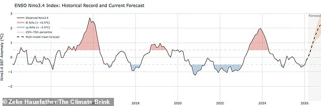
Regions from Australia to California already feel its grip, facing drought or deluge depending on their location. Scientists predict this year's event could match or even exceed the intensity of the 1997/98 cycle.
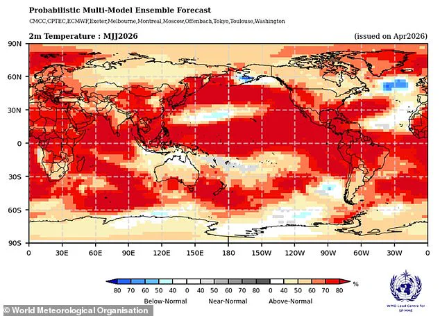
That previous outbreak pushed global averages to their highest point ever. The 1997 event also left a deep mark on British weather, particularly in August.
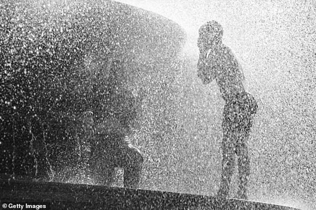
Heathrow airport recorded a maximum average of 25.8°C that month. Temperatures once soared to 31.5°C, forcing residents to seek shade and relief.
While El Niño typically brings dry, hot summers to Britain, it often cools winters. The upcoming shift could begin as early as May or June.
Current data shows tropical Pacific waters heating faster than at any time in this century. Readings suggest surface temperatures might rise 1.5 to 2°C above normal levels.
Wilfran Moufouma Okia, a climate prediction chief at the World Meteorological Organisation, expressed strong confidence in these models. He noted that forecasts point to further intensification over coming months.

Grahame Madge from the Met Office added that all major climate indicators align on one outcome. He stated a sharp temperature spike is expected by August and September.
However, a barrier known as the spring predictability barrier limits long-term certainty. Experts acknowledge that natural seasonal changes complicate forecasts beyond April.
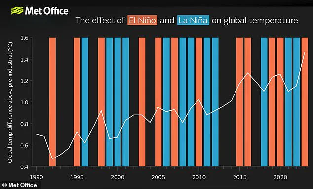
The combination of natural cycles and human-driven climate change creates a dangerous recipe. When El Niño amplifies existing warming, temperatures can jump far beyond historical norms.
Communities face rising risks from extreme heatwaves and potential drought conditions. Vulnerable populations may struggle without adequate cooling or water resources.
Limited access to detailed forecast models restricts public preparation. Only privileged institutions currently hold the full picture of emerging climate threats.
The coming months will test whether Britain can adapt to these rapid environmental shifts. The world watches closely as Pacific waters continue their dangerous climb.
Experts warn that the current El Niño event is poised to be the strongest of this century, with comparisons already being drawn to the significant heat of 1998, which marked the warmest year on record at the time. While the Met Office models indicate sea surface temperatures could rise 1.5°C (2.7°F) above average, the American National Oceanic and Atmospheric Administration (NOAA) forecasts a one in four probability of a "very strong" event pushing anomalies over 2°C (3.6°F).
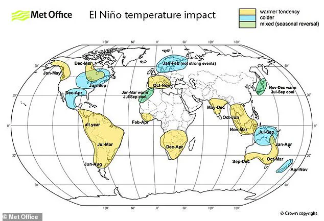
Despite the Met Office's assessment, the full picture remains obscured by limited, privileged access to comprehensive forecasting data. Scientists caution that El Niño is not the sole driver of global weather; other entities interact in complex ways that require extensive further analysis to understand. It is equally possible that these alternative drivers will dominate the weather patterns, a reality that current models may not fully capture due to restricted information flow.
The impacts of this phenomenon are not distributed evenly. Europe and South America face strong temperature increases, while Southern North America risks cold weather and flooding. Crucially, the El Niño–Southern Oscillation is a natural cycle unrelated to climate change, and there is no definitive evidence that the greenhouse effect is making El Niño more severe. However, a powerful El Niño can superimpose an extra layer of atmospheric heat onto the warming already caused by climate change.
This combination creates a significant risk to communities, potentially spiking temperatures to record levels. The year 2024 serves as a stark example, where the convergence of the greenhouse effect and a strong El Niño resulted in the hottest year on record. Without better understanding of how these different forces interact, communities remain vulnerable to unpredictable spikes in global temperatures.
Photos