Record Heat Turns Equatorial Pacific Oceans Brilliant Blue
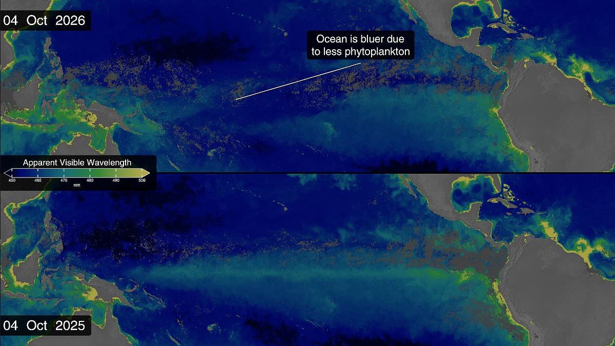
Super El Niño is turning the world's oceans a brilliant blue. NASA satellite images confirm this shift has happened over the last year. The equatorial Pacific once held a lush green color. Now, that hue has vanished. Record-breaking temperatures are to blame. They wipe out marine life in their wake.
El Niño disrupts ocean currents. These flows usually bring cold water up from the depths. That water carries nutrients essential for photosynthesizing plankton. Without food, these tiny organisms starve. A wash of deep blue returns instead. Side-by-side data from 2025 shows the area stayed green all year. But recent measurements through this month reveal a stark change near the equator.
This event is part of the El Niño Southern Oscillation cycle. It repeats every two to seven years. Sometimes it brings hot El Niño periods. Other times cooler La Niña phases arrive. Currently, we are in the early stages of a massive cycle. Experts warn of catastrophic effects coming soon. The National Oceanic and Atmospheric Administration predicts an 83 per cent chance this will be the strongest event since records began in 1950.
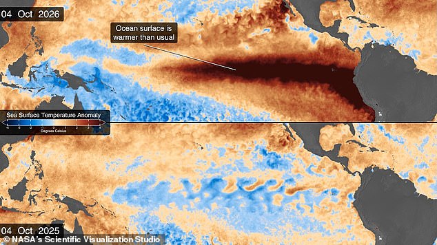
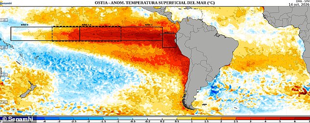
Sea surface temperatures in the eastern Pacific sit 1.7°C above average right now. That is three degrees Fahrenheit higher than normal. Temperatures could jump another fraction of a degree soon. This band of warm water expanded throughout spring. It stretches from South America to the heart of the Pacific. Millions of square miles are affected.
This year marks the first El Niño since NASA launched the PACE satellite in 2024. The Plankton, Aerosol, Cloud, Ocean Ecosystem mission offers an unprecedented view. Its Ocean Colour instrument measures wavelengths across visible, ultraviolet and infrared spectra. Dr Matthew Kehrli from NASA's Goddard Space Flight Center notes water is far more than just blue. He finds it amazing how many colors the ocean can display.
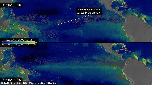
Trade winds typically push warm water westward toward Australia. During El Niño these winds weaken or reverse direction. Upwelling of nutrient-rich waters stops. Algae numbers decline rapidly. Bluer waters result from this drop in phytoplankton. The entire marine ecosystem feels the pain. Animals must relocate to find new feeding grounds.
Scientists detected a major El Niño year coming back in January. Satellites measuring sea levels spotted a Kelvin Wave near Micronesia. These slow pulses span thousands of miles. They act like underwater motorways moving heat west to east. Dr Josh Willis calls them the heartbeat of El Niño. His team watches every beat through sea level satellites.
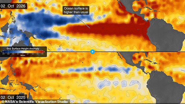
By early April, the wave reached the eastern Pacific. It started warming surface temperatures immediately. Warm water expands and rises too. This caused massive increases in sea levels within the critical region. Areas near South America and California saw rises up to 1.3 feet above average. That is forty centimeters of extra height. Conversely, Indonesia and Australia experienced drops of eight inches.
Dr Willis states El Niño touches almost everyone somehow every time it occurs. The data products show results in real time. Seeing the visual proof is gratifying for researchers. We watch heat spread along Chile's coast out into the south-east Pacific. Boxed arms on maps track these movements clearly. The ocean changes color before our eyes.
Scientists say they must move beyond simply observing what the ocean does and instead focus on understanding exactly why these powerful forces occur. This shift in perspective is critical as new data reveals how deep-sea currents and temperature shifts are altering global weather patterns faster than models predicted just a few years ago. Researchers warn that ignoring the underlying causes could leave nations unprepared for the next major storm or flood event.
"We look to the ocean to understand why," one lead researcher stated during a press briefing this morning. That quote highlights a growing consensus among experts who argue that surface-level observations are no longer enough. They need deep, accurate measurements of subsurface heat content and salinity levels to build reliable forecasts. Without this foundational knowledge, governments risk making decisions based on incomplete information.
Recent satellite readings show ocean temperatures have risen by nearly two degrees Fahrenheit in the last decade alone. That increase fuels stronger hurricanes and more erratic rainfall cycles across coastal regions from Florida to Southeast Asia. Local officials are already feeling the pressure as insurance costs climb and infrastructure plans face scrutiny. Community leaders say they cannot afford another surprise event that disrupts power grids or drowns out low-lying neighborhoods.
The path forward requires sustained investment in monitoring technology and international cooperation on data sharing. No single country can track every shift in the world's waters alone. Sharing real-time observations allows for better warnings and smarter resource allocation during emergencies. Experts insist that waiting for a disaster to strike before acting is not an option anymore.
Photos