New study suggests Earth has only six continents instead of seven
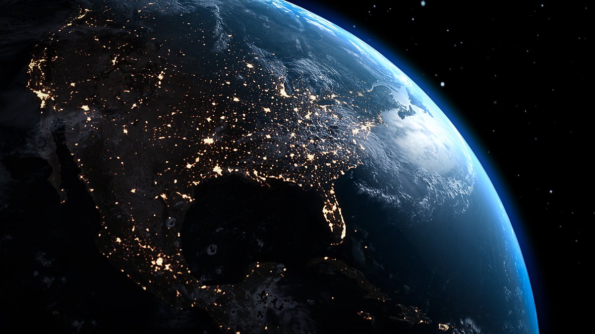
A new study is claiming something that sounds impossible: our planet might actually have just six continents instead of the seven we all learned in school. The research comes from a team at China University of Geosciences and suggests that Australia isn't its own continent but rather part of a single landmass called Sahul, which also includes New Guinea and Tasmania.
This idea traces back to Alfred Wegener's original map, where he grouped these islands together because they share the same crust. The study argues that if you follow the geological reality rather than just political borders or school textbooks, Australia simply doesn't fit the definition of a separate continent in this specific context.
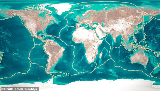
That leaves us with Africa, Antarctica, Asia, America, Europe, and Sahul as the full list. It is a massive shift for how we teach geography and understand Earth's history. Some scientists say it makes more sense to look at landforms formed by tectonic plates rather than arbitrary lines drawn on maps decades ago.
Critics are quick to point out that changing these boundaries causes confusion for students who have memorized the standard seven-continent model for years. They worry about how this affects standardized tests and international agreements that rely on fixed definitions. Still, proponents insist the science is clear and we need to update our mental maps to match what actually exists underfoot.
The debate isn't just academic; it touches on identity and history for millions of people living in those regions. If Australia merges with its neighbors geologically, does that change how we view cultural connections across the Pacific? Experts say the answer depends on whether you value political tradition or pure geological fact more highly.
For now, classrooms will likely keep teaching seven continents because it is easier to explain than this new theory. But the question of what truly counts as a continent remains open, waiting for future research to settle the matter once and for all.
Most people learn in school that Earth sits on seven distinct continents. Yet a startling new theory argues two of them are actually one giant landmass, even with an ocean sitting right between them. Dr Jordan Phethean from the UK's University of Derby champions this idea. He insists North America and Europe remain connected despite the Atlantic Ocean separating them.
'The discovery indicates that the North American and Eurasian tectonic plates have not yet actually broken apart, as is traditionally thought to have happened 52 million years ago,' Phethean stated.
For centuries, geography classes taught there are seven continents: Africa, Antarctica, Asia, Australia, Europe, North America, and South America. The story goes that these lands once fused into one supercontinent called Pangea roughly 200 to 300 million years ago. Heat deep inside the planet eventually pushed tectonic plates apart, dragging the landmasses wide until they formed separate continents.
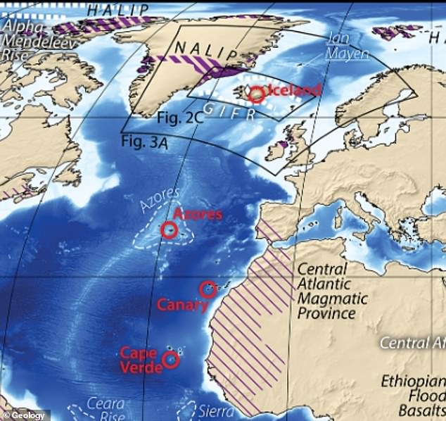
Phethean built his controversial case on two scientific studies showing the two landmasses stay linked by an underwater ridge stretching from Greenland to Iceland and then to the Faroe Islands near Scotland. This bridge in the North Atlantic holds leftover pieces of original continental crust that never fully snapped apart when separation began tens of millions of years ago.
His results revealed chunks of ocean floor much thicker than normal, still connected by thinner continental material. Experts say this is a clear sign North America and Europe never truly separated. Scientists have claimed these findings mean there are only six continents on Earth now.
Researchers measured crust thickness under the seafloor using gravity and seismic scans, then ran computer models to track plate movements millions of years ago. They compared their data against other continents that did separate completely, like Africa and South America.

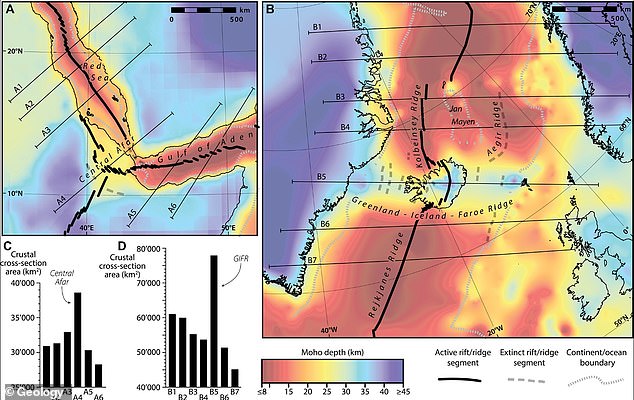
The first study, published in Geology in July 2024, found the actively stretching Central Afar region in East Africa looks very similar to thick crust under Iceland and the Greenland-Iceland-Faroe Ridge. Both places produced huge amounts of volcanic magma early on, built unusually thick crust, and then left behind small pieces of old continental crust inside new volcanic rock. These shared patterns suggest Central Afar is a modern example of how special thick underwater plateaus form when continents fail to break apart cleanly.
In September that year, Phethean's findings in Gondwana Research revealed a submerged piece of thick continental crust between Canada and Greenland that never fully broke away from Greenland. This rock chunk, called the Davis Strait proto-microcontinent, sits 12 to 15 miles thick, far thicker than normal ocean floor. Scans showed the team simulated past tectonic movements and saw the microcontinent begin splitting off between 49 and 58 million years ago, but the process stopped before it became a totally separate landmass.
'It is controversial to suggest that the GIFR contains a large amount of continental crust within it, and that the European and North American tectonic plates have perhaps not yet officially broken up,' Phethean told Earth.com.
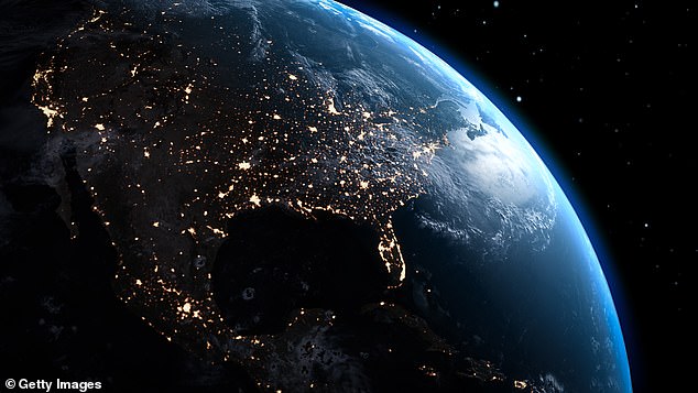
A study in Communications Earth & Environment challenged this theory, claiming researchers misinterpret the origins of thick underwater rocks found between Canada and Europe. An international team concluded the thick, dense crust under Iceland was created by a volcanic hotspot deep inside the Earth that keeps pumping out extra molten rock while the seafloor slowly spreads apart.
Defining 'continents' has always involved a mix of geology, history, and culture. This debate shows how much our understanding of the planet's structure can shift when new data arrives.
For decades, Asia and Europe sat on opposite sides of a mental divide even though they actually form one unbroken landmass known as Eurasia. Scientists have long mapped out this single supercontinent, yet recent research by Phethean and his team in the United States and Europe ignored that specific idea entirely. Their studies focused on other details but never tackled the concept that Eurasia needs to be viewed as a single continent. This oversight leaves a gap in how we understand our own geography today.
Photos