Life-Threatening Tropical Storm Arthur Brings Flash Floods to Texas and Louisiana

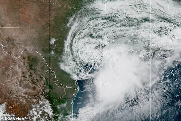
Life-threatening Tropical Storm Arthur has officially formed off the United States coast, marking the first named storm of the 2026 Atlantic hurricane season. The National Hurricane Center (NHC) confirmed the development Wednesday morning, noting that Arthur has intensified to tropical storm status with maximum sustained winds of 40 mph. Currently positioned approximately 40 miles northeast of Port O'Connor, Texas, and roughly 190 miles west-southwest of Lake Charles, Louisiana, the system is tracking northeast along the Texas shoreline before moving inland across southwestern Louisiana later today.
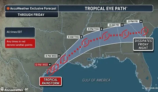
Residents face an immediate and severe threat of widespread rainfall, with totals expected between five and ten inches through early Friday. Isolated areas could receive nearly 20 inches of precipitation, a volume capable of generating dangerous to life-threatening flash flooding. The heaviest rain is forecast to impact the middle and upper Texas coast, extending eastward through Louisiana, Mississippi, and Alabama, and reaching into western Georgia and the Florida Panhandle. Furthermore, forecasters warn of storm surge flooding rising two to four feet above ground level from Port Bolivar, Texas, to Morgan City, Louisiana.
The National Weather Service (NWS) issued a stark warning Wednesday morning: "Efforts to protect property should now be underway." Officials urge communities to prepare for limited wind damage and to complete preparations before winds become hazardous. Citizens are advised to assemble disaster supplies immediately and to familiarize themselves with evacuation routes. The NWS highlighted that major flooding could trigger evacuations and water rescues, overwhelm rivers and drainage systems, and render roads and bridges impassable. Streets and parking lots are expected to flood rapidly, creating extremely hazardous travel conditions.
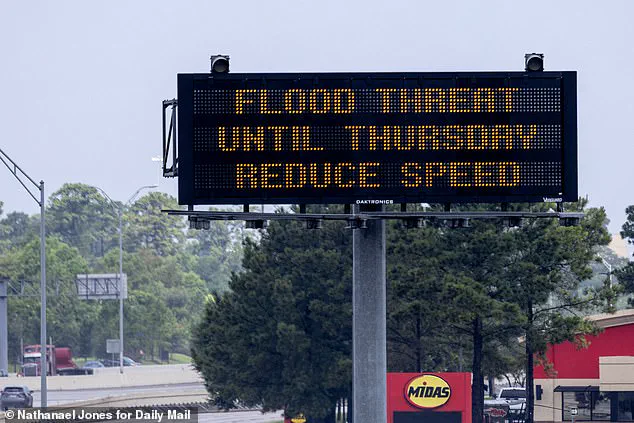
Beyond the immediate rain and surge, swells generated by Arthur are projected to create life-threatening surf and rip current conditions along portions of the northwestern Gulf Coast for the next several days. Offshore waters are expected to experience hazardous conditions, with winds exceeding 46 mph and seas building to heights of 11 feet. The NHC director, Michael Brennan, emphasized during a briefing that the primary threat is a prolonged, multiday heavy rainfall event. He stated, "The main threat from Arthur is going to be a prolonged, multiday, heavy rainfall event that could produce dangerous to life-threatening flash flooding," noting that flash flood warnings have already been issued in the Houston metro area with more likely to follow, even after the storm's center passes.
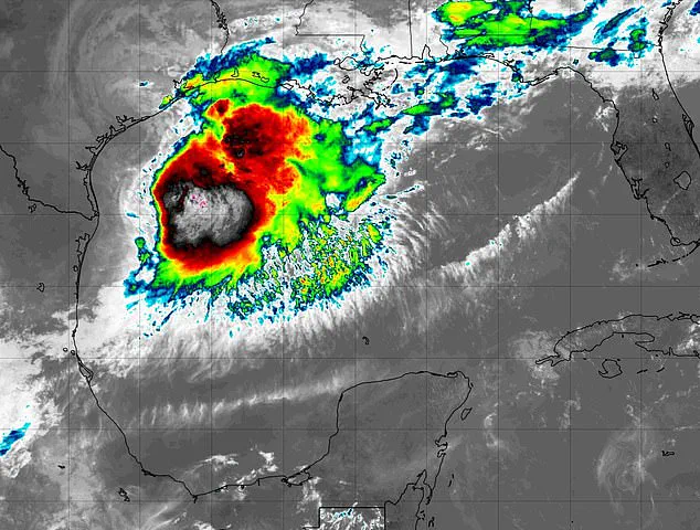
Tropical Storm Warnings are currently in effect stretching from High Island, Texas, to Morgan City, Louisiana, where tropical storm conditions are expected within the next 12 hours. A Tropical Storm Watch remains active from Sargent to High Island, Texas, indicating that tropical storm conditions are possible in those areas during the same period. Despite the severe weather, Houston is set to host Wednesday's World Cup clash between Portugal and the Democratic Republic of the Congo. The match is expected to proceed as scheduled, with the city's covered stadium providing necessary shielding for both fans and players against the storm.
Photos